In 1913
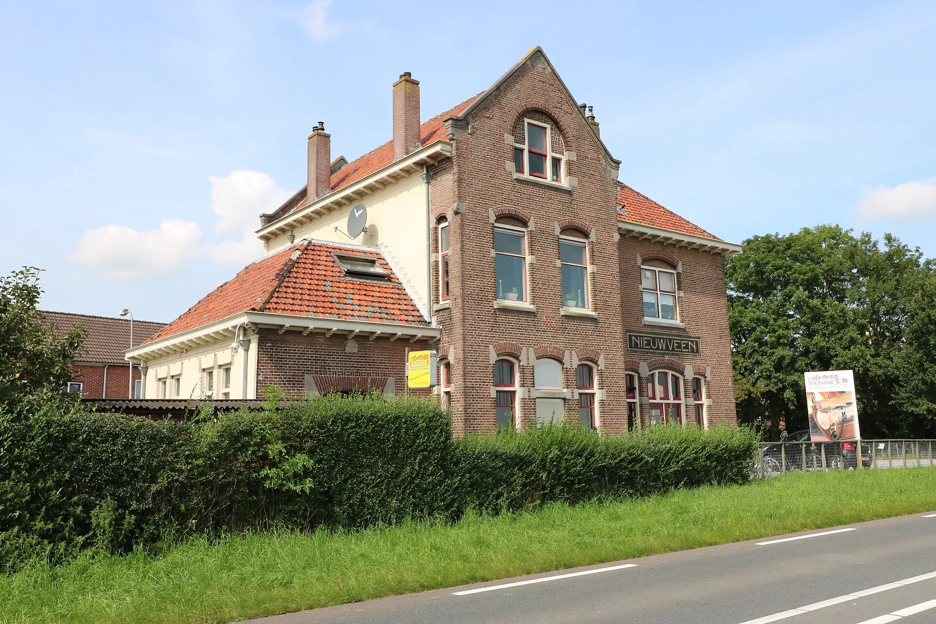
The station building at Nieuwveen is built, to the Hesm I standard type.
Provenance This line was not in the typed document. It was looked up in public sources afterwards and added.
On this spot
Former Nieuwveen station
- 1915 On 1 August 1915
- 1918 In January 1918
- 1936 On 1 January 1936
Connected to this
Other events sharing these topics.
In the year 1559
A new Roman Catholic church goes up on the Kerkstraat, replacing the small one already there. The old church was dedicated to St Anne; the new one took St Nicholas as its patron.
On 14 July 1831
The foundation stone is laid for the new Reformed church on the same site. The architect is Elsmeyer of Nieuwkoop.
Under the State Regulation of 1798 the tower had become the property of the civil municipality, and it is therefore rebuilt at the municipality's commission, to a design by Theo Molkenboer of Leiden. The cost is estimated at 2,100 guilders.
On 22 April 1832
The new Reformed church in the Kerkstraat is taken into use.
 The church taken into use in 1832 in the entry beside this, a little over a hundred and forty years later. View larger →
 In 1888
The foundation stone for the Johannes Stichting is laid on the street then still known in common speech as the Dorpsstraat, now the A.H. Kooistrastraat.
On 1 August 1915
Opening of the railway connection between Uithoorn and Alphen aan den Rijn, with among others a station "Nieuwveen", at the end of what is now the W.P. Speelmanweg.
The original document gives 1916 as the year of opening and Amsterdam as the terminus; the line ran from Uithoorn to Alphen aan den Rijn and opened on 1 August 1915.
The line was 23 kilometres long and was built by the Hollandsche Electrische-Spoorweg-Maatschappij as part of the Haarlemmermeer railways. Because it mostly carried horticultural produce, it was popularly nicknamed "het bonenlijntje", the bean line.
In January 1918
The HESM opens a short goods branch from Nieuwveen to Papenveer. The station there is given the name of Ter Aar, two kilometres further on.
 The Nieuwveen–Ter Aar branch on a map of 1914, attached to the interest-free advance from the treasury that paid for the line. View larger →